Detect it.
Automatically locate and classify pavement distress from roadway imagery.
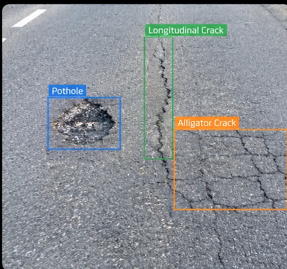
PaveX turns ordinary vehicles into intelligent pavement survey platforms—combining depth-aware sensing, AI, and standards-based rating to help agencies inspect streets, arterials, highways, and freeways at scale.

PaveX does more than capture pavement images. It detects distress, measures its severity and geometry, and tracks how conditions evolve over time—turning field data into quantified pavement intelligence.
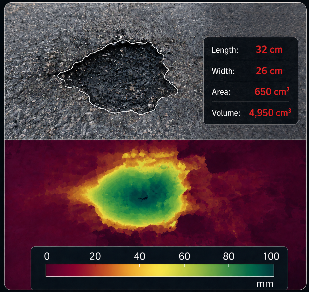
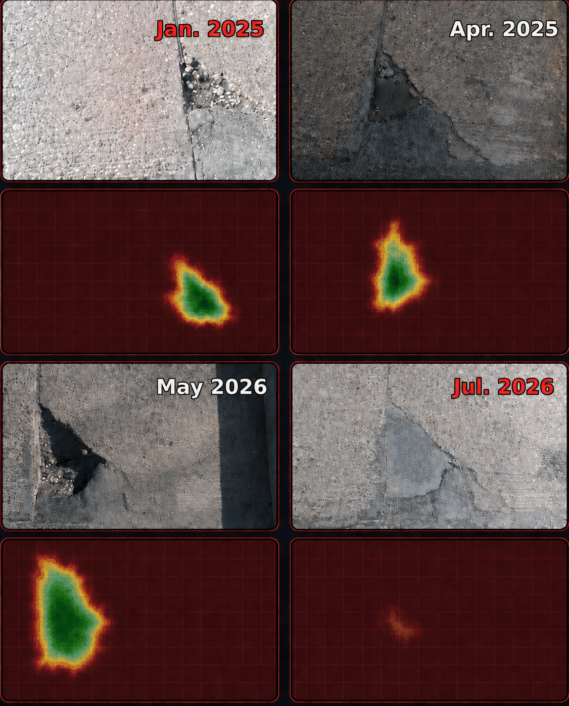
A practical workflow designed for network-scale inspection and repeatable condition assessment.
Vehicle-mounted RGB-D sensors, positioning, and vibration data capture pavement while the vehicle travels the network.
AI and computer vision identify distress, while depth data supports geometry, severity, and dimension measurements.
Generate PASER, PCI, and related condition outputs, including PCI workflows aligned with ASTM D6433.
Receive GIS-ready condition maps, location-linked imagery, distress information, and repeat-survey history.
Move from network-level condition to individual roadway locations with GIS-linked imagery and quantified distress evidence.
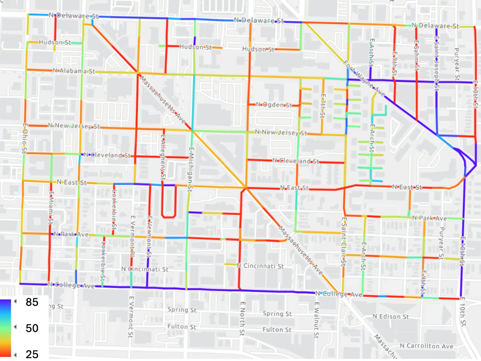
Color-coded network results help agencies visualize condition at scale and prioritize action.
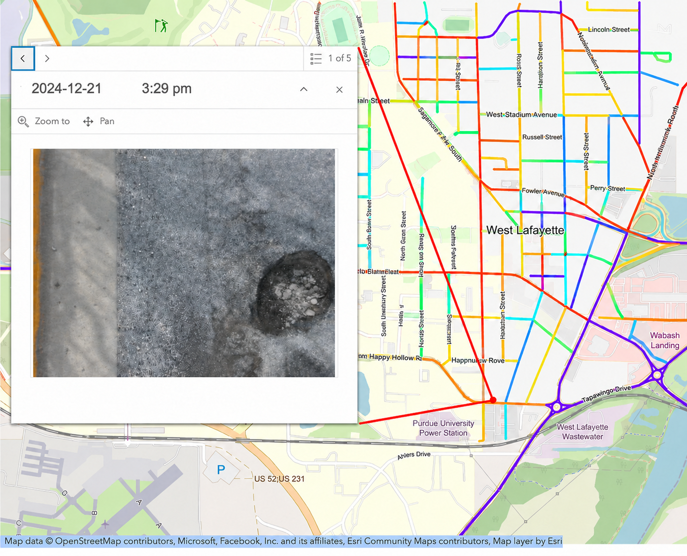
Map-linked imagery lets engineers move from segment-level scores to image-level review.
Selected full-scale deployments and pilot studies demonstrate PaveX across real municipal roadway networks. The same platform is designed to scale to counties and transportation agencies managing broader networks.
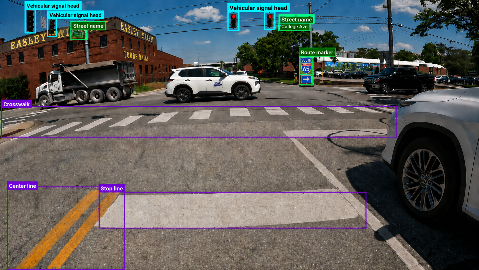
Beyond pavement condition, PaveX can use the same roadway imagery to detect, classify by type, geolocate, and inventory a broad range of traffic signs and pavement markings. The platform can also assess the observable condition of these assets using MUTCD-informed criteria. These georeferenced records help agencies maintain up-to-date inventories, prioritize field verification and maintenance, and support more consistent roadway asset management.

NSF SBIR Phase I support is helping PaveX advance its pavement-intelligence platform toward broader municipal, county, and DOT deployment—from local streets and arterials to highways and freeways.
Talk with PaveX about a pilot, network-wide pavement survey, corridor assessment, or repeat-condition program.
Request a demo